

Description
Open Source GIS and Mapping
by Gary Sherman
Desktop Geographic Information System (GIS) software gives you the ability to make maps and analyze geographic information. This book provides a foundational level of knowledge for understanding GIS and the open source desktop mapping applications that are available for use, for free, today.
Learn about vector and raster data, how to convert data, interacting with spatial databases, creating new map data, geoprocessing, scripting, and more. Special sections include focused learning on the Quantum GIS and GRASS GIS software platforms but other packages are also introduced. The Geospatial Desktop is written by the founder of Quantum GIS (QGIS), so you can rest assured that you will be led by one of the most knowledgeable authors on the subject.
Locate Press is proud to bring this work back into print by releasing this updated edition. Originally known as Desktop GIS: Mapping the Planet with Open Source Tools, this popular book quickly sold out and was out of print for far too long. If you are looking for a very readable and reliable text for learning more about open source mapping desktop applications, this is the book for you.
See Gary’s website dedicated to the book – GeospatialDesktop.com to learn more about the book and to see an Annotated Chapter List.
Sample Chapters
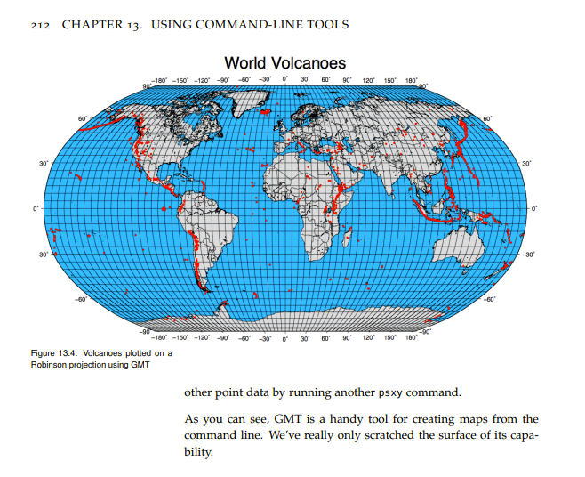
- Chapter 13 – Using Command Line Tools (PDF, 914 KB)
- Chapter 15 – GIS Scripting (PDF, 725 KB)
 Â


